A modern flight bag built around real pilot decisions.
ClearRoute Pilot puts FAA charts, live weather, terrain awareness, and AI briefings that explain their reasoning into one iPhone and iPad app — online or fully offline.
Advisory use only. ClearRoute is not certified for navigation. It is a planning and situational-awareness aid: pilots remain responsible for official briefings, regulatory compliance, aircraft performance, and every go/no-go decision. AI-generated content is advisory and should always be reviewed by the pilot.
At a glance
VFR sectionals, IFR enroute low & high, and Terminal Area Charts in one seamless map — with downloadable offline packs.
METARs, TAFs, SIGMETs, winds aloft, PIREPs, and TFRs, plus an animated radar loop updated every two minutes.
Echo tops, precipitation type, hail, lightning, rotation tracks, and 250 m NEXRAD super-resolution.
Aircraft-relative terrain shading on the chart, and a 3D synthetic view with advisory terrain alerts.
Route, weather, and radar summaries in plain language — with the reasons, and the pilot always in command.
Route builder, altitude optimizer, alternates, weight & balance, and takeoff/landing performance from your POH numbers.
Geo-referenced FAA approach plates overlaid on the moving map, with a nearby-plate picker.
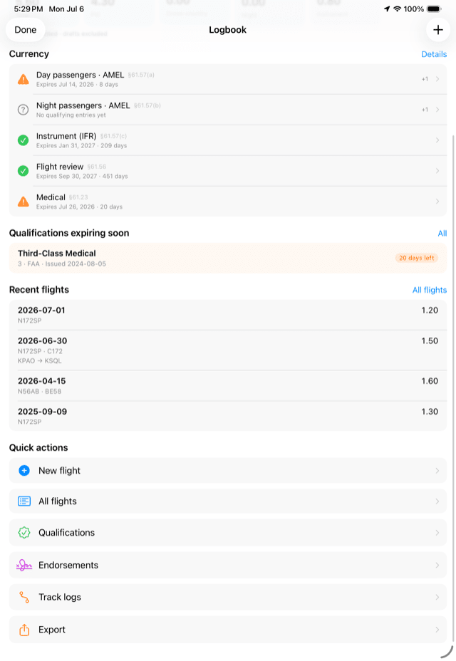
Digital logbook with currency tracking, signable endorsements, and PDF export.
Charts, online or offline
ClearRoute stitches every FAA VFR sectional into one seamless, gap-free chart of the United States — no sheet edges, no reloading between charts — and does the same for IFR enroute low and high charts and Terminal Area Charts. Switch bases with one tap; charts refresh automatically on the FAA's 56-day cycle, and the effective dates are always shown on screen.
- Smooth, maps-style pan and zoom across the whole US
- VFR sectional, TAC, IFR low, and IFR high bases — plus an Apple Maps base
- Downloadable regional chart packs for fully offline flying
- Track-up or north-up orientation, ownship symbol, and state outlines
- Glide and endurance range rings drawn around your aircraft
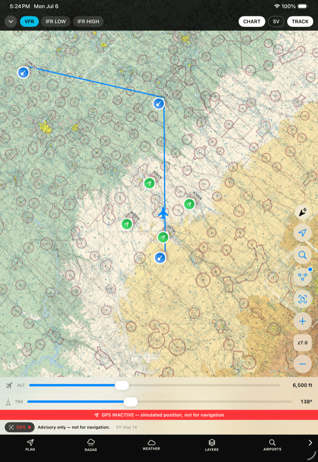
Why it matters: a chart you can trust to be current and available — with or without a connection — is the foundation everything else builds on.
Weather & radar
Weather in ClearRoute is both textual and spatial: decoded METARs, TAFs, SIGMETs, winds aloft, PIREPs, and TFRs alongside weather markers and an animated radar loop drawn directly over the chart, refreshed every two minutes from NOAA MRMS data.
- Decoded and raw text for every report, with airport-by-airport weather views
- Animated composite radar loop over any chart base
- Radar Intelligence engine PRO — base reflectivity, precipitation rate and type, echo tops, VIL, hail, lightning probability, storm rotation tracks, and per-site NEXRAD Level II super-resolution imagery
- AI radar evaluation PRO — an advisory, plain-language read of the radar loop over your area: what the echoes are doing, which way they're moving, and the trend
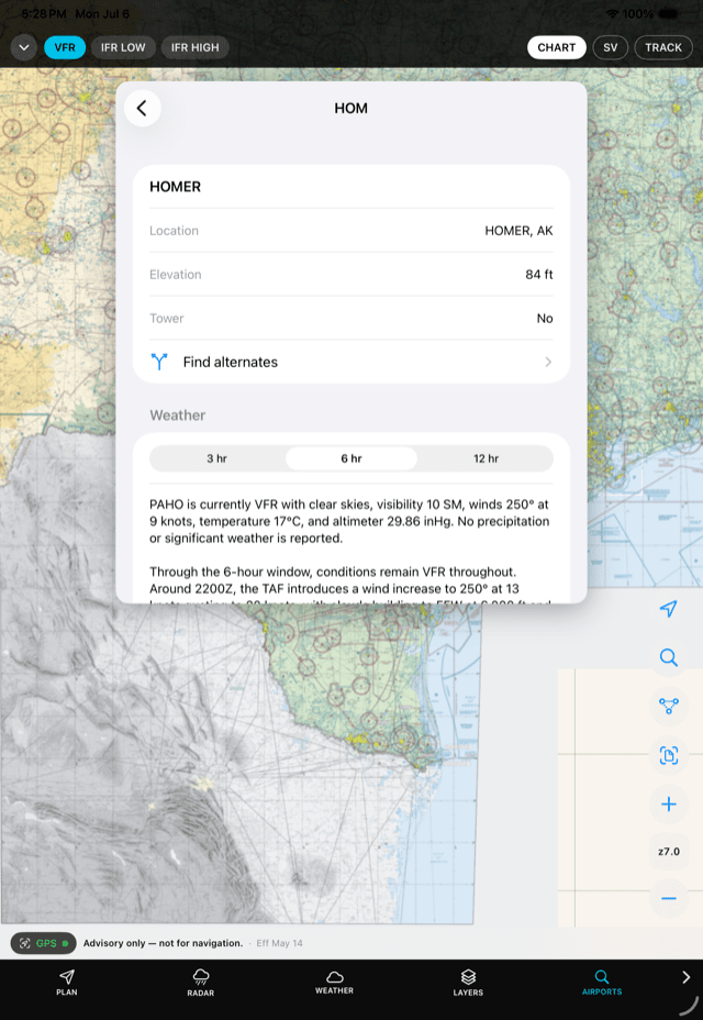
- Per-airport AI weather summaries for the next 3, 6, or 12 hours
- FAA weather cameras matched to airports, so you can see actual conditions
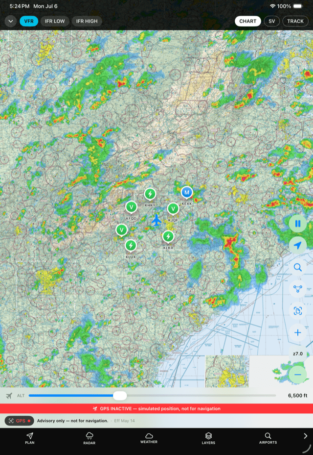
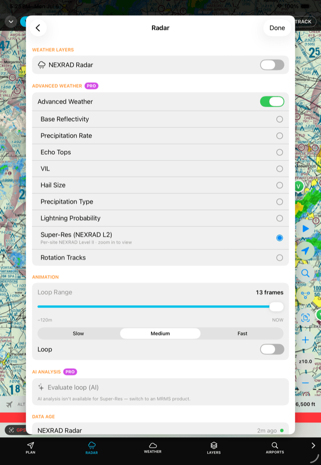
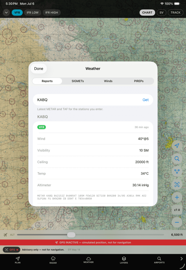
Why it matters: the picture that keeps you out of weather isn't one product — it's radar, reports, forecasts, and cameras agreeing with each other.
Terrain, synthetic vision & safety
ClearRoute renders USGS elevation data two ways: a shaded-relief terrain layer for context, and an aircraft-relative mode that shades terrain red at or above your altitude and amber within 1,000 feet — recomputed as you climb and descend.
- Aircraft-relative terrain shading (TAWS-style, advisory) on the moving map
- Synthetic vision PRO — a 3D terrain view with advisory terrain-ahead alerting, runway markers, and a split-screen chart+3D layout on iPad
- Elevation, minimum-safe-altitude, and glide-footprint queries along your route
- Personal minimums: set your own ceiling, visibility, wind, and night/marginal-VFR limits and have plans checked against them
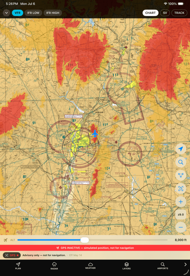
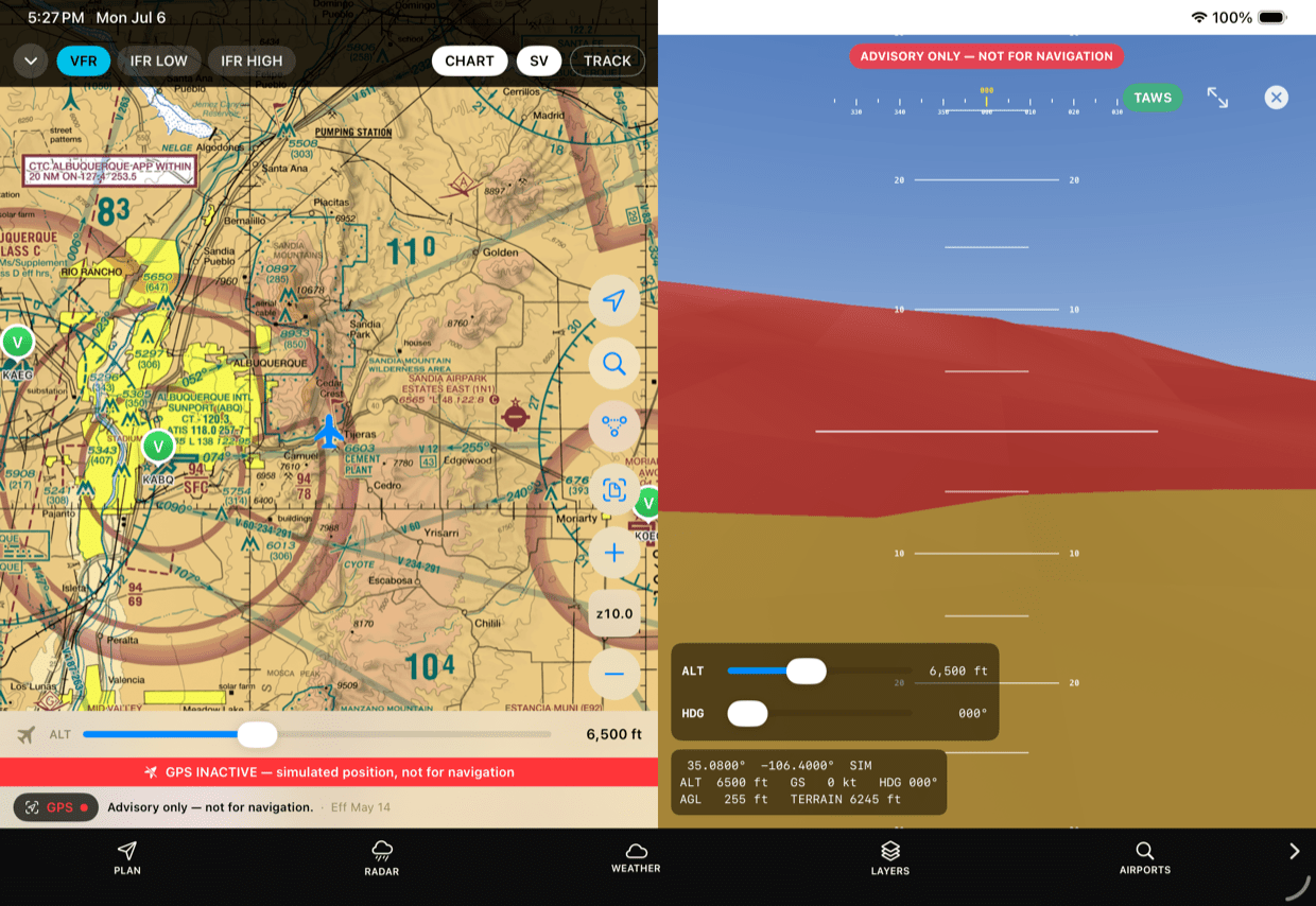
Why it matters: terrain awareness relative to your altitude — not just a pretty relief map — is what turns elevation data into a safety net.
AI briefings that explain the plan
ClearRoute's AI features are built to one rule: they summarize and explain, the pilot decides. Every AI output is labeled advisory, shows what data it looked at, and never replaces an official briefing.
- Route briefing — corridor weather, hazards, and risk factors along your planned route, summarized in plain language
- AutoRoute planning PRO — an advisory route, altitude, fuel, and alternate recommendation that states its reasons, flags contingency points along the way, and discloses the quality of the data it used
- Radar evaluation PRO — storm movement and trend, read from the live radar loop
- Airport weather summaries — terminal-area outlooks in a sentence or two
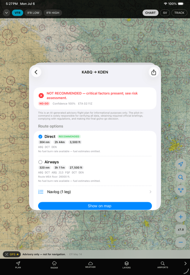
Why it matters: data tells you what; a good briefing tells you why. ClearRoute's AI is there to make the planning picture clearer — final authority stays in the left seat.
Planning, weight & balance, and performance
Plan with airports, waypoints, and airways; compare route candidates; pick your altitude with a winds-aloft optimizer; and find alternates fast. Then load the airplane with your own POH numbers.
- Route builder with saved routes and an active plan drawn on the map
- Airway MEA/MOCA inspector for IFR altitude planning
- Winds-aloft altitude optimizer and route-candidate comparison
- Nearest-alternates finder with map markers
- Weight & balance from your aircraft's envelope and stations, with a CG plot — sample data is always clearly flagged until you enter your own
- Takeoff and landing distance from your POH performance tables
- Navlog with PDF export, fuel planning with reserve warnings
- Community-reported fuel prices and a true-cost-of-fuel calculator that weighs the price against the detour
- Flight plan filing — draft, validate, and brief your flight plan, then file, amend, activate, or cancel it, with push notifications as its status changes and an AI assistant for the tricky fields
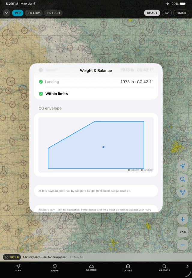
Why it matters: performance and loading answers are only as good as the numbers behind them — ClearRoute uses yours, and tells you when it's showing samples.
Airports & procedures
- Airport details: runways, frequencies, and nearby-airport search
- Tap anywhere on the chart to identify airports, airspace, and hazards
- Geo-referenced approach plates on the map — FAA instrument approach plates overlaid in position on the moving chart, with opacity control and a proximity picker that offers nearby plates as you approach
- Full-page plate viewer for briefing the whole procedure
- SID, STAR, and approach procedure data from the FAA's official CIFP coding, refreshed on the 28-day cycle, for procedure-aware planning
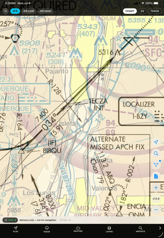
Why it matters: seeing the approach plate in position under your ownship closes the gap between the chart in your head and the one out the window.
Traffic & ADS-B
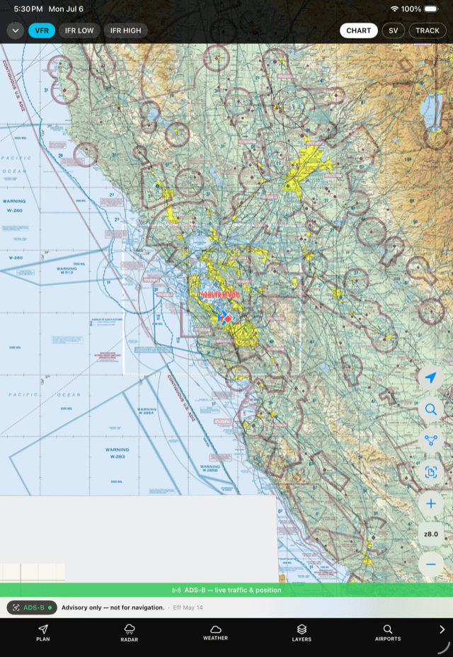
Connect a portable ADS-B receiver (Sentry or Stratux-class, GDL 90 over Wi-Fi) and ClearRoute shows traffic as relative-altitude diamonds on the chart and in synthetic vision, with proximity alerting — and uses the receiver's GPS as your ownship source.
Logbook & records
- Digital logbook entries with attachments
- Currency tracking, qualifications, and signable endorsements
- PDF export of your logbook
Built with privacy in mind
No advertising, no analytics, no tracking. The app can run on a shared temporary account with no personal information, sign-in tokens live in the device Keychain, and all traffic is TLS. Read the full privacy policy.
Our commitment to safe use
ClearRoute is a decision-support and planning aid. It does not replace official weather briefings, NOTAM checks, or approved navigation equipment, and its AI features are advisory summaries — not instructions. The pilot in command retains full responsibility for every flight.
Want to try ClearRoute Pilot?
Ask about early access